Kate Cough is editor of The Maine Monitor. She previously served as enterprise editor for The Monitor while also covering energy and the environment and writing the weekly Climate Monitor newsletter. Before joining The Monitor, Kate was a beat reporter for The Ellsworth American and digital media strategist for The Ellsworth American and Mount Desert Islander. Kate graduated with honors from Columbia University Graduate School of Journalism and Magna Cum Laude from Bryn Mawr College. Kate is an eighth generation Mainer, who lives on Mount Desert Island with her husband, daughter, and dogs.
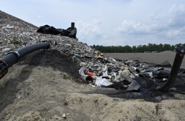
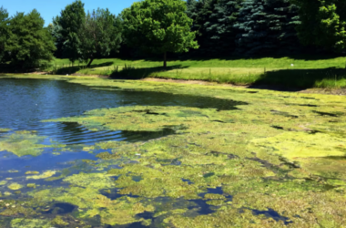
The amount of road salt being using, coupled with leaking old septic systems and an increased use of fertilizers and pesticides to kill ticks and mosquitoes and manage invasive plants, are among the greatest threats to future water supply.
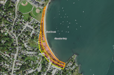
Those in favor of updating the maps say the changes will help clarify the location of the dunes, which are at risk of erosion and submergence from flooding and sea level rise.