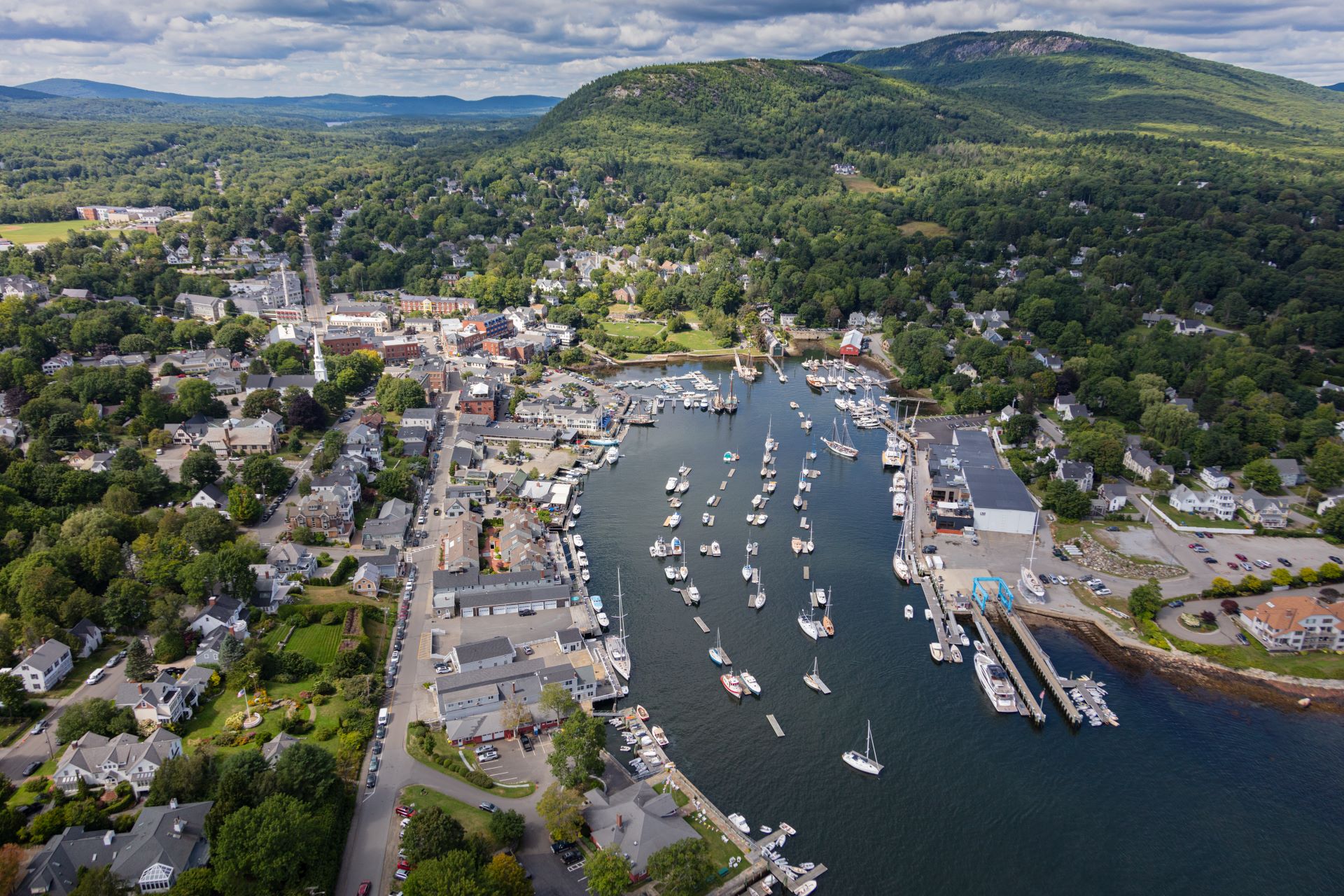

Camden Harbor is known to sailors on the Maine coast to be two things: one of the prettiest harbors, and one of the most uncomfortable. Curtis Island and the ledges do little to blunt the force of the rollers swinging in to the outer harbor from Penobscot Bay.
The earliest inhabitants of the land, the Penobscot, dubbed the harbor Megunticook, which translates roughly to “great swells of the sea,” for the immense waves that sweep through during storms.
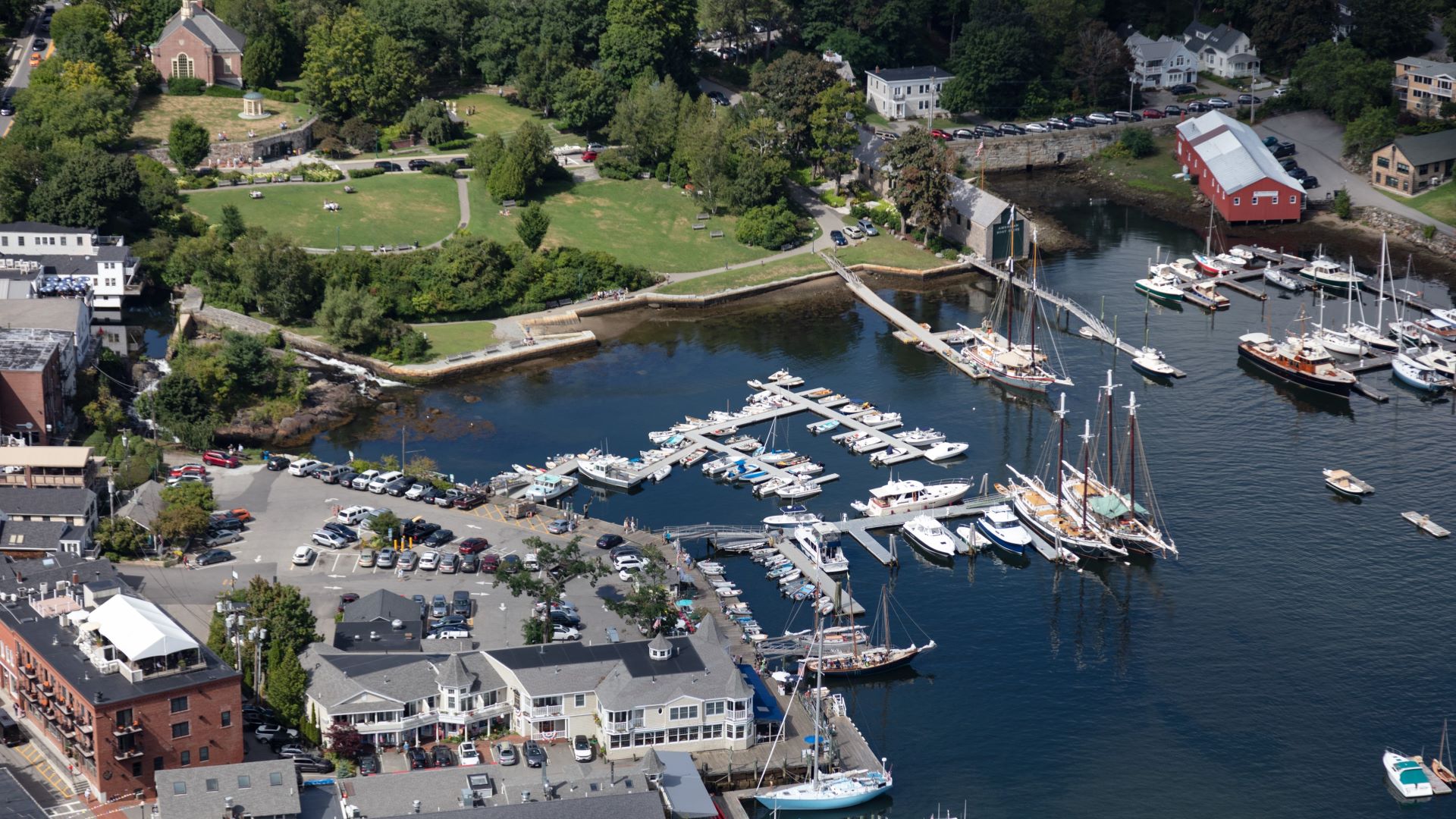
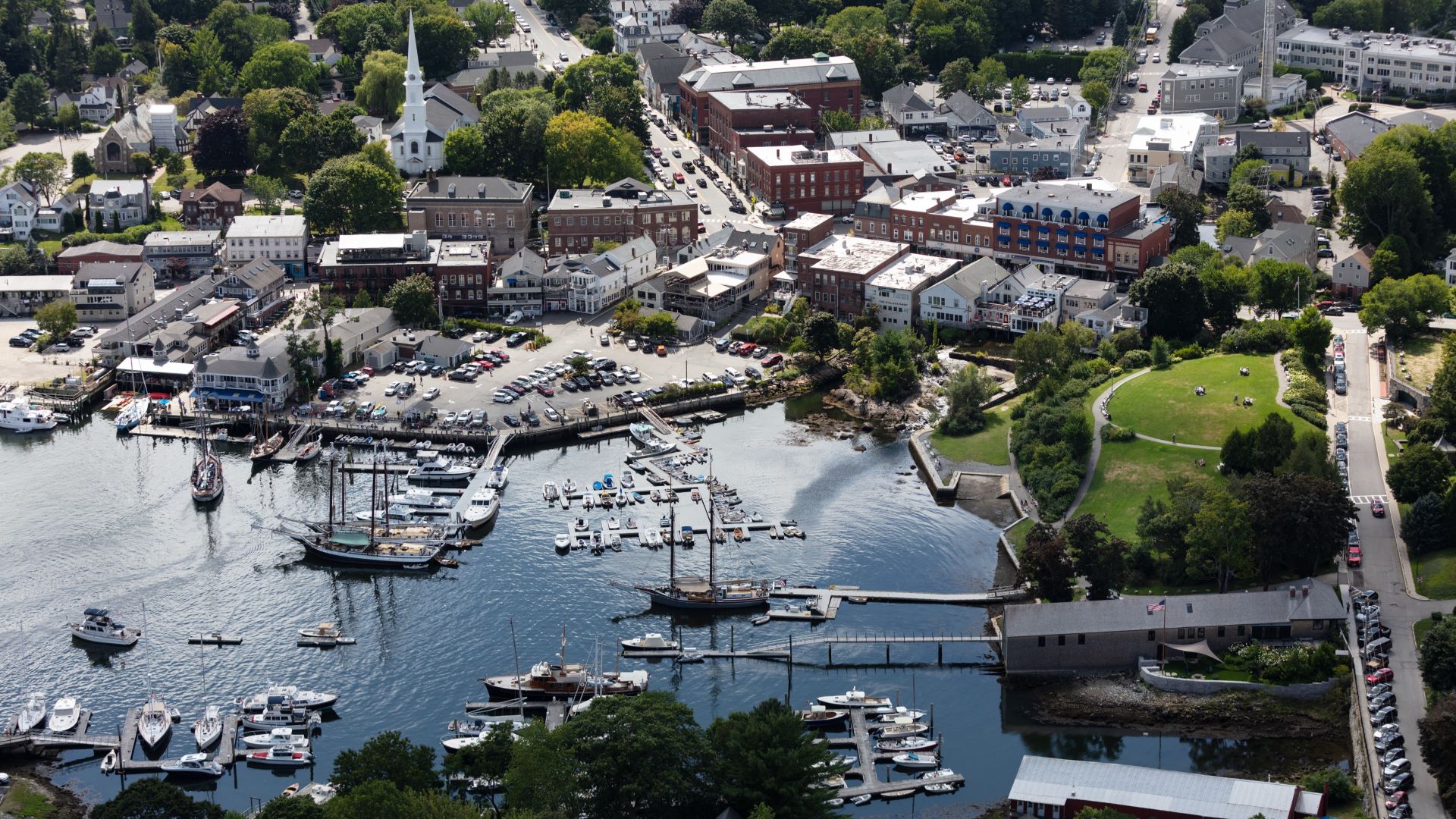
But it is also this nearness to the sea that gives the town its magic. At high tide, diners cracking lobster shells at one of the wharfside restaurants can reach over the rail and nearly touch the glittering water, and guests aboard any of the numerous elegant sailboats slipped in the inner harbor need amble only a few feet to their berths after indulging in one too many dark n’ stormys.
On a warm and windy afternoon in July, Alison McKellar was standing on the wharf with her nine-year-old son. He was trying to catch pogies — the small, silvery fish often used as lobster bait — using a cast net, which, when held up by its tapered end, looks a bit like a witch’s hat made of soft white mesh.
Spending time by the water, McKellar noticed something that surprised her. Several times a month, the ocean would overtop the granite seawall separating the Megunticook River and Harbor Park, submerging the legs of the picturesque waterfront benches and flooding the parking lot of the harbormaster’s office.
“I kind of became obsessed with it,” said McKellar, who serves as vice chair of the Camden Select Board. She began venturing down to the harbor anytime the tide was high – at night and in the winter, when seas sloshed into parking lots filled with piles of muddy snow. She saw areas where the grass stopped growing because it was too full of salt water. The more time she spent, the more alarmed she grew.
Even using the most conservative projections, sea level rise will flood eventually much of Camden’s picturesque waterfront during high tide. Add storm surges and more frequent and intense rainfall events, and the town is facing the potential for millions of dollars in property damage and loss, as well as higher flood- insurance rates and the risk to town infrastructure not designed for saltwater.
A foot and a half of sea level rise would put large swathes of the town’s harbor parking lot, where residents and visitors gather to watch the striking yachts and historic schooners glide in and out of their berths, underwater during annual King Tides.
A number of waterfront buildings would also be periodically swamped: a 2017 report by the Watershed School found that $16 million worth of Camden’s waterfront property, accounting for roughly $260,000 in annual property taxes, would be at risk with just a foot of sea level rise.
A one-foot rise is all but certain. State officials have said towns and cities should commit to managing for 1.5 feet of relative sea level rise within the next 30 years, and they recommended preparing for double that. At three feet, $32.8 million worth of coastal property would be at risk of being lost or damaged, along with $528,444 in annual property taxes. Storms could push the water even higher.
Some residents told McKellar she was overreacting. Property owners swore that the kind of dramatic flooding she was seeing happened once, maybe twice a year, and even then it was predicted, the result of a supermoon or a heavy rain. “As if, because it was predicted,” McKellar marveled, “it’s not a problem.”
To prove the skeptics wrong, McKellar began documenting the overflowing tides. They happened monthly, sometimes several times a month. Many occurred at night, without witnesses, so she made it a point to come to the waterfront even after dark, filling her phone with images of the swelling sea.
As she photographed, she talked: to business owners, visitors, diners, sailors, seasonal residents and those who had lived in Camden their whole lives. To McKellar, most people seemed more inconvenienced than concerned.
“I’m sure they would say sea level rise is real and humans are causing it,” said McKellar. “But they somehow think we’re not going to actually need to make any infrastructure changes here.”
The conversation is changing, said Town Manager Audra Caler, but translating high-level policy into action is complicated, particularly in such a historic place where development has continued to intensify.
Camden saw a huge influx of new residents during the pandemic, many of whom have been building out properties along the coast, said Caler, even as town officials warned that zoning ordinances do not account for sea level rise.
“They’re investing in extremely expensive infrastructure that isn’t going to hold up in the future.” In June, the town put in place a moratorium on all new piers, floats and docks on private property, in an effort to slow development while ordinances are updated.
“It’s difficult. It’s political,” Caler continued. “You have people who, you know, spent a great deal of money acquiring these properties, and now they want to invest in them … It’s sort of a hard road to go down for a municipality, even if there’s a really good reason to do it, like climate change resiliency.”
A proposal to remove a historic dam on the harbor front and replace it with a living seawall is a recent high-profile example. Residents have been arguing over the plans for years, even as granite blocks meant to hold the water at bay have to be periodically dragged back into place after being displaced by storms.
“It’s really easy to say that you’re supportive of planning for climate change,” said Caler. “But when you have to give up your own property rights, or give up a value that you hold dear, or a configuration of a piece of public infrastructure that you find to be appealing or important — that’s, that’s where it becomes difficult.”
She paused.
“We’ve got this immediate crisis but we just don’t have a system to be able to respond to it quickly enough.”