
It’s a long way from the pretty, protected waters of Christmas Cove, a tranquil mooring field at the outlet of the Damariscotta River, to that river’s namesake town, 14 miles north. Those who arrive by boat — after running the gauntlet of lobster buoys and aquaculture gear (the river is one of Maine’s most productive oyster-growing spots) – will eventually reach the twin villages of Newcastle and Damariscotta, former mill and fishing towns that now boast a lively trade in summer tourism.
But the journey upriver is not a long way for the swells of the ocean, which periodically crest up and over Damariscotta’s parking lot and swamp the low-lying Miles Street causeway connecting one of the area’s most vital pieces of infrastructure, the campus of LincolnHealth hospital, to the mainland.
“We pay close attention to (a high tide) if we’re on the outskirts of a hurricane or there are big rains coming,” said Cindy Wade, the hospital’s president, “because it can quickly become a problem.”
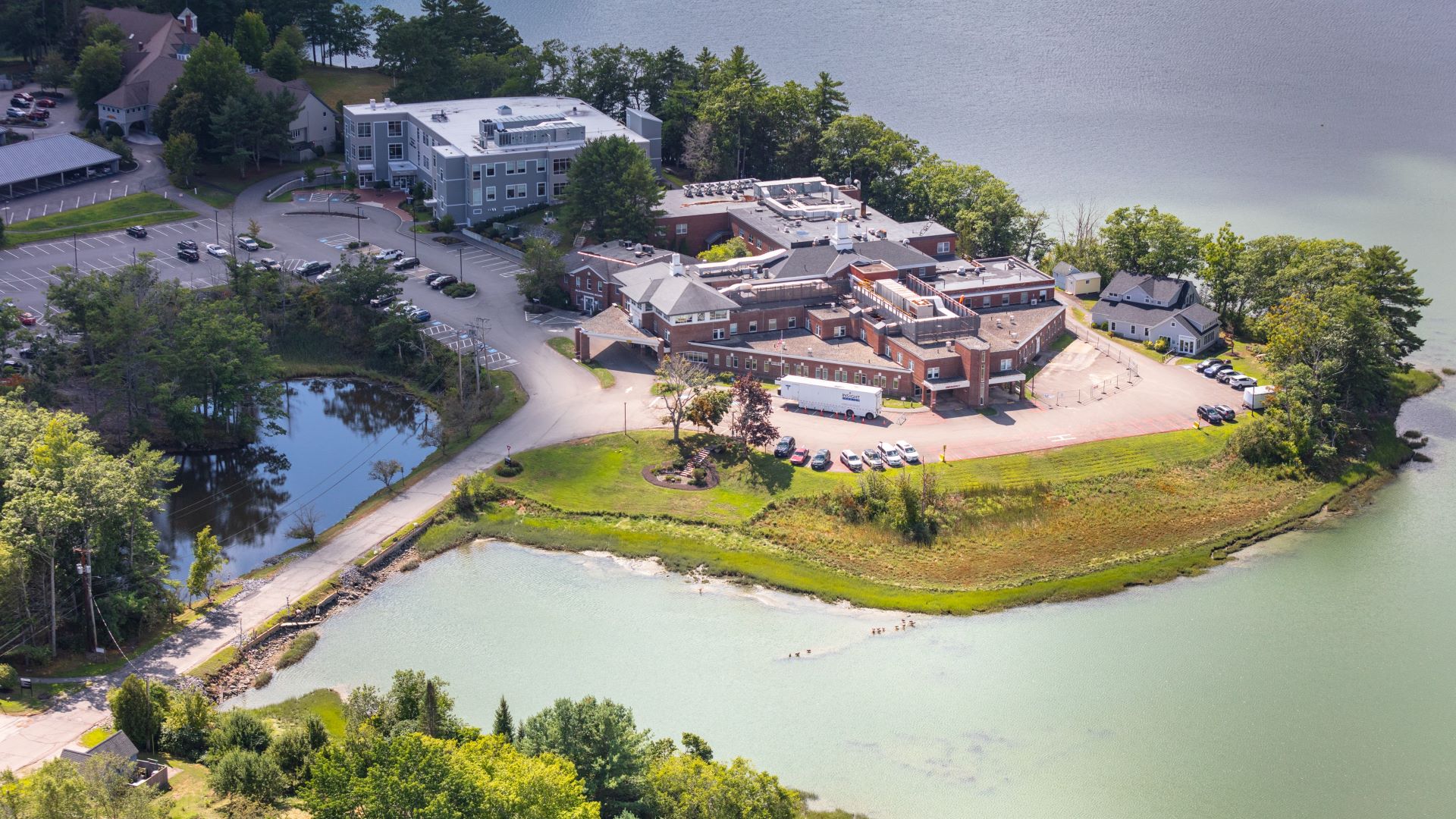
The sprawling campus, perched on the edge of picturesque Days Cove, houses the typical hospital offerings — emergency room, outpatient services, primary care — as well as a continuum of senior-living facilities.
There is another entrance, off Schooner Road, but it’s a smaller, one-lane road, said Wade, more difficult and less direct for emergency vehicles to use.
In recent years, with stronger storms and higher tides, the town has been forced to close the main road to the hospital several times a year, and the rising river has been eroding the edges of the causeway.
“Sometimes the rain is damaging enough,” said Wade. “We have to close it down and have it come to be assessed by an engineer, and we have had to have work done to it.”
“It’s a huge issue, not only for Damariscotta but for the region generally,” said Isabelle Oechslie, who works as town planner for Boothbay and Damariscotta.
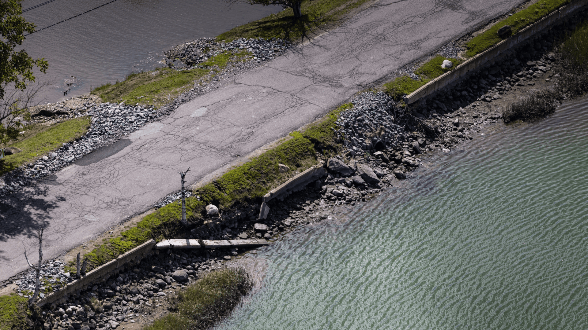
The town and hospital came up with a plan to raise the road a foot higher than its current height, which is already above the 100-year high-tide mark, said Wade. But after a bit more analysis, engineers decided it would be best to raise it two feet to account for sea level rise, storm surges and increased rainfall. The town and hospital have set aside up to $600,000 for the project, which has yet to go to bid.
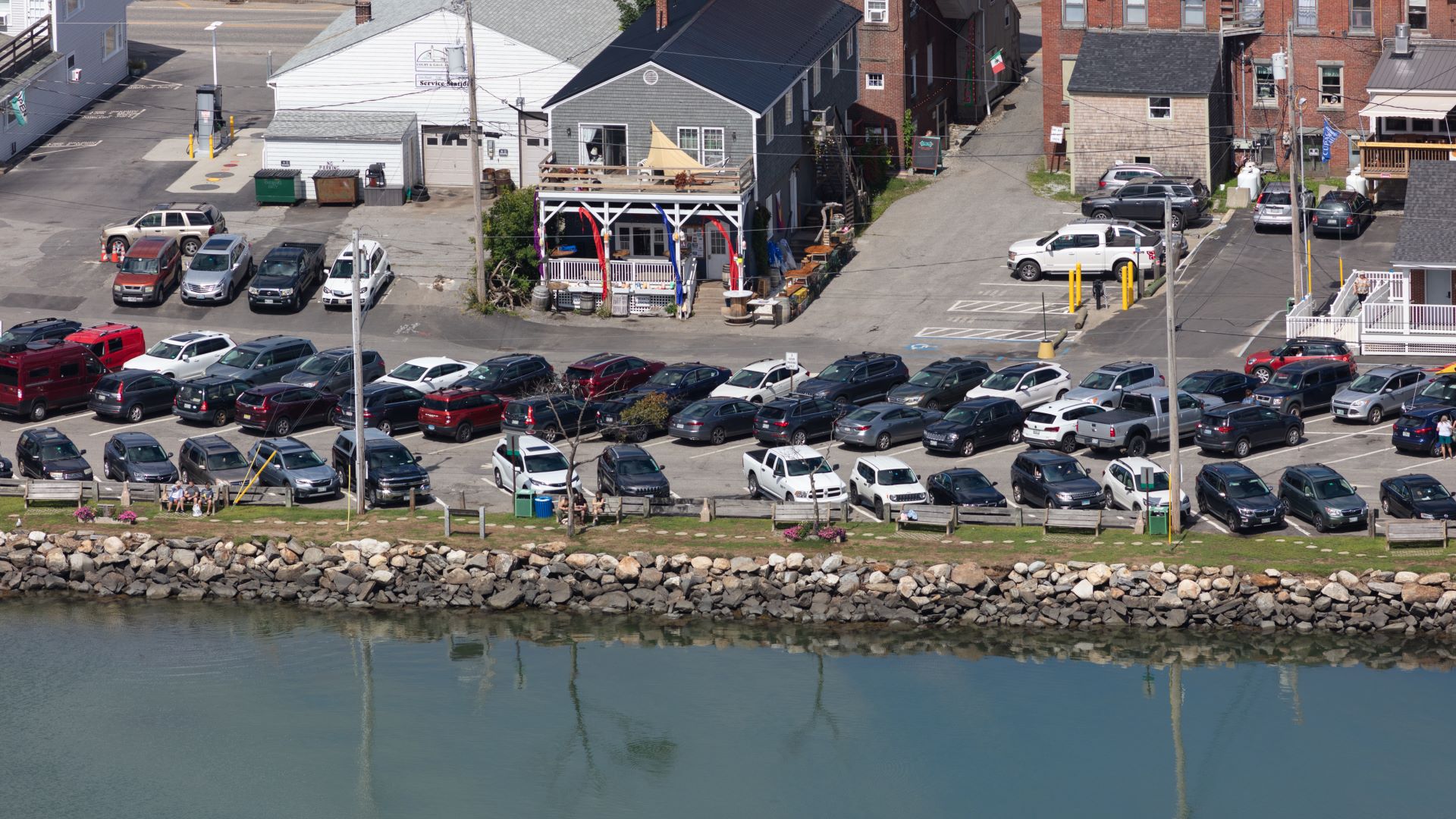
The hospital isn’t the only infrastructure at risk in Damariscotta. High tides during storms already push the river up and over the parking lot downtown and occasionally into the first floors of businesses in the town’s most important economic and historic corridor, said Oechslie.
Even 14 miles upriver, Damariscotta is one of the most vulnerable towns on the coast to sea level rise, according to a recent adaptation study conducted by state and federal agencies.
Flooding downtown is only expected to get worse in the coming decades. With 3.9 feet of sea level rise, which is expected by the end of the century (if not before) nearly the entire parking lot will be submerged during King Tides.
The study advised planning for flooding five feet above the harbor parking lot. That amount of water would inundate sections of Main Street, along with the basements and ground floors of roughly 16 of Damariscotta’s 22 historic brick buildings, which are listed on the National Register of Historic Places.
To protect the area, officials have settled instead on building a three-foot seawall along the shoreline. Storm drains also will be replaced with one-way valves, allowing water to flow out but not in.
But implementing the plan is proving more expensive than expected, particularly in the chaotic post-COVID construction era.
“It’s sort of on pause as we continue to seek additional funding,” said Oechslie, and these funds can be especially challenging to access in rural communities.
The town had most of the estimated $4.4 million in hand as of last fall and hoped to start construction this spring, but the most recent estimates came in closer to $5 million, forcing the town to hold back. “That’s part of what makes this difficult.”