
The meeting, held on a warm and breezy evening in late June, was heated from the start. Residents from Machias and beyond packed into the high school gym to hear the latest plans from state officials on what they propose to do about a rapidly deteriorating dike in the middle of town, the only structure standing between the Atlantic Ocean and more than 50 landowners upstream on Middle River.
“We hay down there. We have cattle,” said Chris Sprague, who worries about losing the dike. “I live on a peninsula. My land will be a swamp, and I could just stand here and cry … It affects a lot of people,” said Sprague, who began to cry.
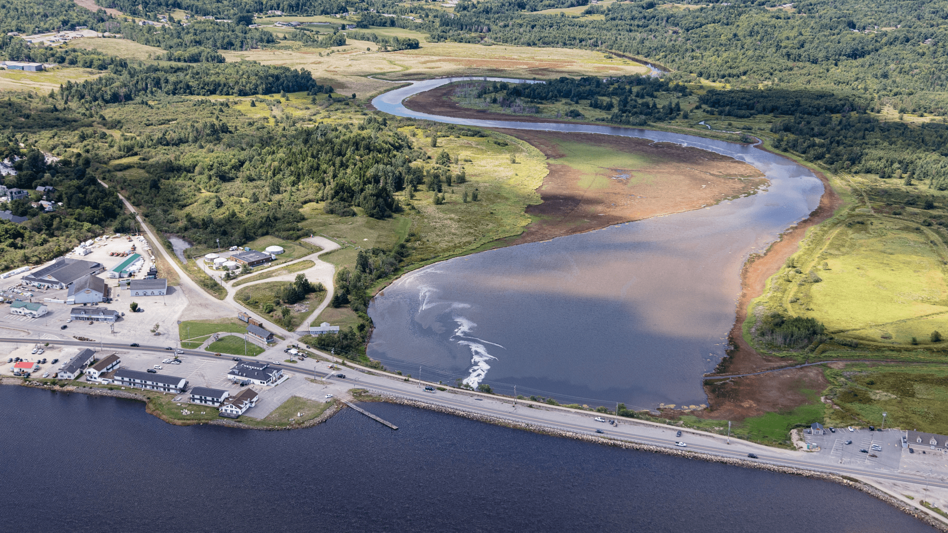
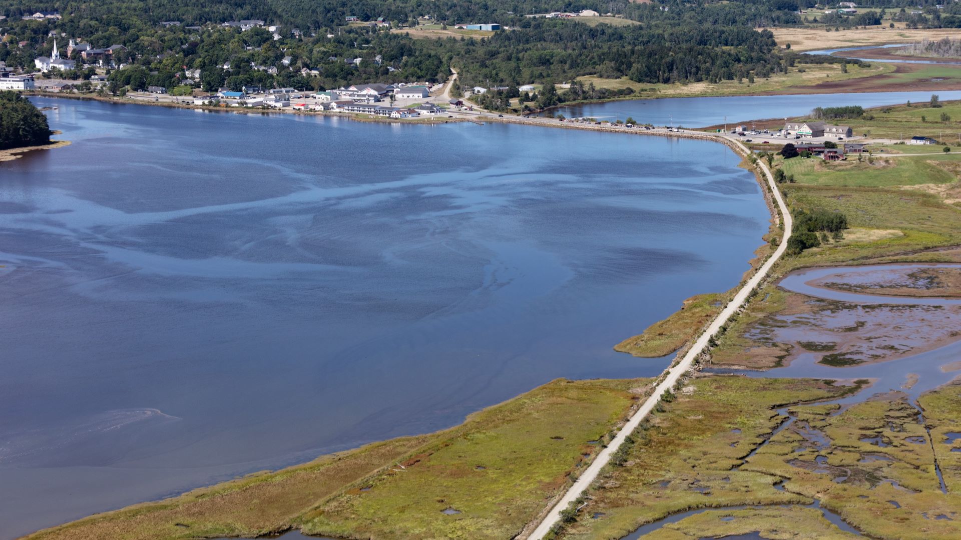
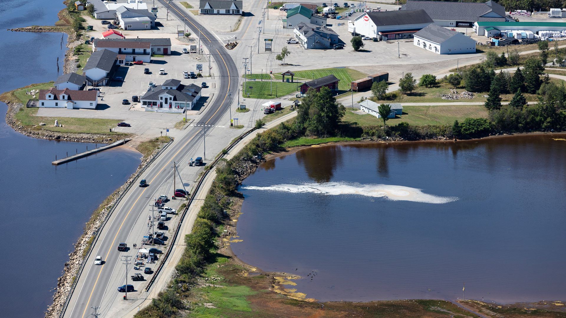
As it stands now, the upstream fields that Sprague’s family has been haying for generations are shielded from the sea by a causeway of piled earth and stone, constructed in the late 1860s. The dike and causeway essentially function as a dam with a road on top — busy Route 1, the primary connection point for towns Downeast. Four one-way gates under the road (known around town as “clappers”) allow water to flow out from the river to the sea (but not the other way around).
Except that in recent years, the sea has been coming upriver anyway. Higher tides and storm surges have flooded up and over the road, nibbling at its edges and eroding the embankments. Four box culverts that allow water passage below the causeway are nearly a century old and in dire need of replacement. A violent storm and spring tide in April 2020 left seaweed and debris scattered along Main Street for the second time in just a few months.
“An engineer told me he thought we were just an inch or two of a storm surge away from losing the dike entirely,” said Tora Johnson, professor and director of the GIS Laboratory at the University of Maine at Machias, who has studied the dike and talked about it for more than a decade. “It would have been a pretty epic disaster for the whole region.”
Johnson and her colleagues have warned for years that rising seas in the Gulf of Maine would soon flood the causeway regularly, but many in the area were skeptical. “They’re like, ‘Yeah, yeah, it’s not really ever gonna happen.’ And then it started happening, and now it’s happened four times in six years.”
State and federal officials have tried to find a fix for the problem for nearly 15 years. After exploring more than 20 options and holding dozens of public meetings, they’ve arrived at one of the two first presented back in 2009: a traditional bridge, stretching roughly 1,000 feet, with a wide span in the middle for water to flow back and forth.
Simply replacing the dike with something similar, Joyce Taylor, chief engineer of the Maine Department of Transportation, told residents at the meeting in June, was “no longer viable.” Construction could begin in 2024. Cost estimates are still being determined.
Removing the dike and installing a traditional bridge would flood the area upstream, turning much of it back into salt marsh, which was what first drew European settlers to the area in the early 1800s, before the causeway stopped the tides from flooding in. That would protect against rising seas by restoring the marshland, which is particularly good at absorbing large amounts of floodwater and releasing it back slowly.
But removing the dike would also submerge land along the riverbank from Machias to Marshfield, hundreds of acres of land that residents have been haying and hunting and fishing and living off of for more than 150 years. While the government has said it will reimburse affected landowners at fair market value for what’s lost, that cannot compensate for the loss of a way of life.
“It’s been heartbreaking to watch — for years, since I was in high school — my dad being jerked back and forth,” said Hannah Rice, Sprague’s granddaughter. If the bridge is built, 90 percent of the family’s land would be underwater twice each day, making it essentially unusable.
In many ways, the problem of the little dike on the Middle River is a tidy encapsulation of the interests that collide when we’re faced with a climate that is forcing us to change the way we’ve lived for decades, or even centuries.
Property owners are worried about losing money, livelihoods, and connection to a place that’s remained largely unchanged for generations.
Conservation groups want to see the restoration of the iconic Atlantic salmon and the return of the salt marshes, which sequester carbon, provide valuable habitat, and serve as a nursery for clams, lobsters and groundfish. Clammers worry about disturbing an old junkyard upriver, which could contaminate the flats and devastate the industry in the area.
Everyone wants more protection from floods and rising seas, and more security for the cultural and economic hub of the town. Any fix will be costly, and the longer it takes, the more urgent (and expensive) the situation becomes.
As Johnson has been speaking to and surveying residents over the years, most of the skepticism around climate change has receded, if only because the impacts are so evident. Now Johnson’s work often boils down to one question: “What is it that we can say and do that helps to protect and honor the dignity of others?”
The problems are urgent, Johnson continued, which makes finding common ground to solve them all the more essential.
“Chances are pretty good that if you don’t even utter the words ‘climate change’ you’ve got something in common,” said Johnson. “Start there. When people start there, they get things done, and when they don’t, all they do is argue and they get stuck.”